Two distance options:
50K: The 50K race will start on Saturday, July 25, at 7 a.m. The course consists of three loops: a RED loop, WHITE loop and BLUE loop (loop descriptions below). Cutoff time for the 50K: 5 p.m. (10 hours). The 50k course has approximately 3,000 feet of climb.
50 Mile: The 50-mile race will start 7 hours earlier on Saturday, July 25 … at 12:01 a.m., midnight! The 50-mile consists of two RED Loops, two WHITE loops, and one BLUE loop. Cutoff time for the 50 mile: 5 p.m. (17 hours). The 50 mile course has approximately 5,000 feet of climb.
COURSE MARKINGS
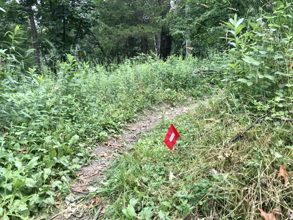
Each loop will have color-coded flags with reflective tape for each respective loop. There will be Red, White and Blue flags depending on which loop you are running. The flags will be on your right hand side. In some cases there is two-way traffic, so they could be on BOTH the left and right. Turns will be marked with two flags, signs and trail markings. The trail systems also has very vibrant trail signs that are highly reflective.
LOOP DESCRIPTIONS
Please reference the map on the Whiterock Conservancy homepage while reviewing the loop descriptions.
Red Loop (7.8 miles)
- From the Start line, head EAST and connect with the Main Loop Trail.
- The Main Loop trail will turn and head north up a hill. Turn RIGHT (EAST) onto Bluebell Trail (single track/equestrian/pea gravel), stay on Bluebell until it intersects again with Eastern Spur/Main Loop Trail.
- Take a RIGHT (East) on Eastern Spur/Main Loop, then turn LEFT (North) onto White Oak Trail. Stay on White Oak Trail until it intersects with Eastern Spur/Main Loop Trail.
- Follow Eastern Spur and Stay RIGHT (West) on Main Loop Trail.
- Follow Main Loop Trail into Oak Ridge Campground. Water is available here. The trail will go through the campground to 125th St.
- Turn left (West) on 125th St. Follow 125th St. until it comes to a T intersection with Fig Ave. Continue Straight on Main Loop Trail.
- Follow Main Loop Trail until Red Rock Climb. Turn left (South West) on Red Rock Climb.
- Follow Red Rock climb to Bobcat Trail. Turn Left (South) on Bobcat Trail.
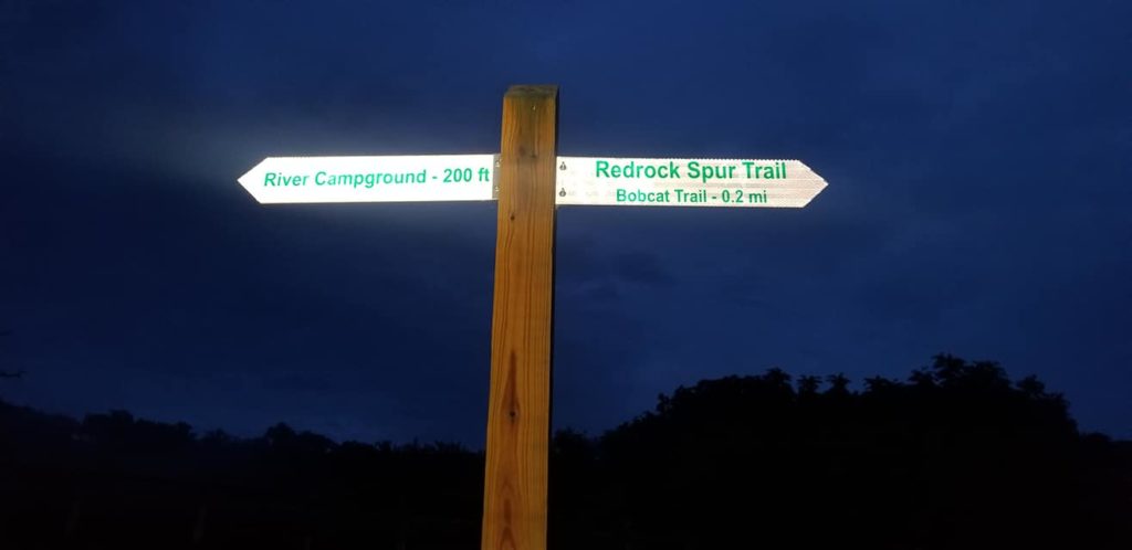
- Follow Bobcat trail to Red Rock Spur. Turn Left (South) on Red Rock Spur and follow the trail under the bridge back to River Campground for AID.
White Loop (11.4 miles)
- Leave the River Campground Aid Station, turn right (West) on Fig Ave. over the bridge, turn left (South) and connect with Shooting Star Trail.
- Follow Shooting Star trail and turn Right (South) on to Big Dipper Trail.
- Turn Right (South West) on Little Dipper Loop to head to Star Field campground.
- Little Dipper trail will enter into Star Field campground. Water is available here. Signs will be posted to continue East to rejoin Little Dipper Trail.
- Continue on Little Dipper and veer right (NE) onto Big Dipper Trail. Stay on Big Dipper until you reconnect with Shooting Star Trail.
- Turn Right (North) to stay on Shooting Star Trail. Runners have the option to exit Shooting Star trail on to Fig Ave to receive aid at the River Campground or they skip the aid station by running under the Fig Ave bridge and continuing on the course.
- If the runner went to the aid station, Exit River Campground South and turn right (SW) to Fig Ave. Head SW on Fig Ave. over the bridge. Turn Right (NW) onto Riverside Trail.
- Stay on Riverside Trail until it connects with Long Creek Trail.
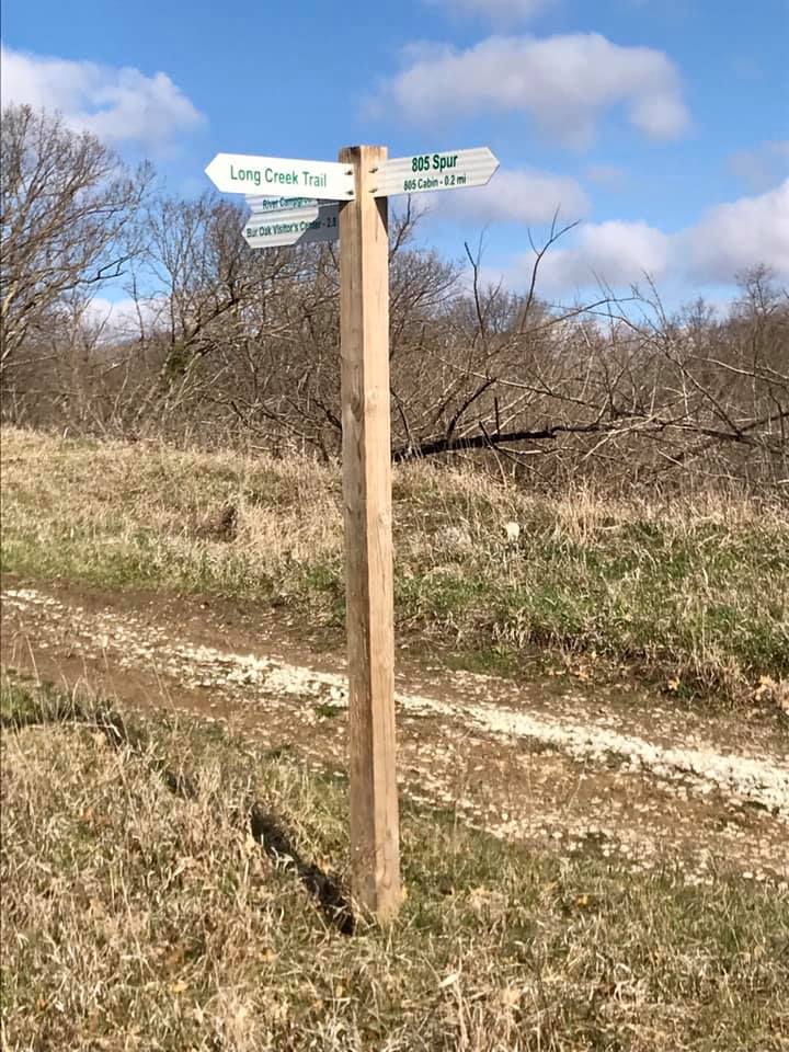
- Turn left (WEST) onto Long Creek Trail; stay on Long Creek Trail until it connects with the 805 spur.
- Turn right (South) down 805 Spur, past 805 River cabin and reconnect with Riverside Trail.
- Continue south on Riverside Trail. Turn left (East) onto Fig Ave. After crossing the bridge, turn left (North) and follow the trail to loop under the bridge back to River Campground.
Blue Loop (11.7 miles)
- From the start/finish at the River Campground, head north up the Red Rock Spur until Redrock Climb.
- Turn right (East) on to Redrock Climb. Follow Redrock Climb to Main Loop Trail.
- Turn Left (North) on to Main Loop Trail. Follow the Main Loop Trail to End Lane.
- Turn right (North) on to End Land (gravel road). Follow End Lane to Main Loop Trail.
- Turn Left (West) then a quick right (North) to get back on to Main Loop Trail. Follow the Main Loop Trail to Steve Garst Trail.
- Turn right (North) on to Steve Garst Trail. Follow Steve Garst Trail into Coon Rapids.
- Follow Steve Garst Trail until it ends/runs into Main Street. Turn Left (West) on Main Street. Follow Main Street until 5th Ave.
- Turn Left (South) on to 5th Ave. Follow 5th Ave. until the Coon Rapids Golf Association and Town Loop Trail. Follow the Town Loop Trail under Highway 141.
- Follow the Main Loop Trail to Garst Family Pond – AID STATION. Continue Straight (South) to go around Garst Family Pond and go up Completely Unnecessary Hill.
- Follow Lake Loop until it comes to Garst Family Farm Rd. Turn Left (North) on Garst Family Farm Rd.
- Continue on Garst Family Farm Rd. and then take two quick right turns (South).
- Follow Town Loop Trail. Stay on the Town Loop Trail (Right) and head south back to Main Loop Trail.
- Connect with the Main Loop Trail and continue south. Make a quick right (West) onto Sunrise Trail.
- Follow Sunrise Trail until it connects to Main Loop Trail.
- Turn Right (South) on to Main Loop Trail. Follow Main Loop Trail until 805 Spur.
- At 805 Spur, there are three possible routes; Left, straight and right. Continue straight (South East) on the trail that may not necessarily look like a trail. This is the Main Loop Trail.
- Follow the Main Loop Trail to Prairie Spur. Turn Left (East) to stay on Main Loop Trail. Follow Main Loop Trail to Fig Ave.
- Turn left (East) on to Fig Ave. After crossing the bridge, turn left (North) and follow the trail to loop under the bridge back to River Campground to the FINISH!!